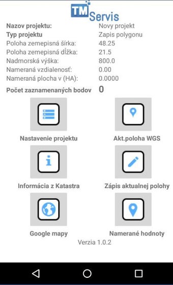
GPS Kataster: A Useful Tool for Agricultural and Geodetic Purposes
GPS Kataster is a free Android app developed by Maroš Tkáč. This app is designed to help customers who work in agriculture, urban communities, geodetic firms, and engineering network projects. It is useful when measuring areas, identifying land plots, marking replacement land plots, and dividing large agricultural plots for subsidy declarations and self-control.
This app offers a user-friendly interface and easy-to-understand instructions for use. It is a valuable tool for those who need to measure land on their own, without the assistance of a surveyor. The app is also helpful for urban communities and local authorities, as it allows them to keep track of land ownership and land use changes. Overall, GPS Kataster is a valuable app for anyone who needs to measure land quickly and accurately.